The Quiz Question
Which US state has the longest coastline?
The answer is Alaska. Here is the full story.
Alaska's Jaw-Dropping Coastline
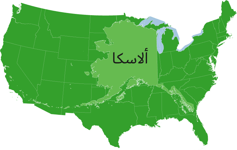
When most people picture a long American coastline, they think of Florida, California, or maybe the Gulf Coast stretching across Texas. But those states aren't even close to the top. Alaska's coastline is so enormous it dwarfs every other state combined — and the numbers back that up in a stunning way.
Alaska has approximately 33,904 miles of coastline when you measure every tidal inlet, island, and bay. For context, the entire contiguous United States — all 48 lower states put together — has roughly 19,924 miles of coastline. Alaska beats that figure by nearly 14,000 miles on its own.
Why Is It So Long?
The secret is Alaska's geography. The state is riddled with a maze of islands, fjords, inlets, and peninsulas that dramatically multiply the total measurable shoreline. The Alaska Peninsula juts out into the Pacific for about 500 miles, and then the Aleutian Island chain continues for another 1,200 miles beyond that, curving toward Russia like a string of stepping stones.
Then there's the southeastern panhandle — a narrow strip of land threaded between Canada and the Pacific — packed with thousands of islands, channels, and deeply carved fjords left behind by ancient glaciers. Places like the Alexander Archipelago alone contain hundreds of individual islands, each adding their own coastal edges to the total count.
How Do You Even Measure Coastline?
This is where things get philosophically interesting. Coastline measurement is notoriously tricky because of something called the coastline paradox. The smaller the unit of measurement you use, the longer any coastline becomes — because you're capturing more of the tiny bends, curves, and notches. Alaska's highly irregular, deeply indented geography makes it particularly sensitive to this effect.
The figure of 33,904 miles comes from the National Oceanic and Atmospheric Administration (NOAA), which measures tidal shoreline — meaning it includes the shores of offshore islands, sounds, bays, rivers, and creeks to the point where tidal waters narrow to 100 feet wide. Using a simpler "general coastline" measurement, Alaska still wins handily at around 6,640 miles.
Second Place Isn't Even Close
Florida comes in second place for tidal shoreline at around 8,436 miles — a distant runner-up. California sits at roughly 3,427 miles. Even if you added Florida and California together, you'd still fall well short of Alaska's total.
A Coast That's Mostly Wild
Perhaps the most remarkable thing isn't just the length — it's how untouched most of it is. Vast stretches of Alaska's coastline are accessible only by boat or floatplane, lined with temperate rainforest, volcanic peaks, glaciers calving into the sea, and wildlife ranging from brown bears to humpback whales. It's one of the most dramatic and least-visited coastlines on the planet, sitting right there in the United States.